
Road Trip to Geiranger – The Complete Guide
Geiranger isn’t just a fjord village – it’s one of those places that feels like it was designed to leave you speechless.
Tucked away in a narrow valley at the end of the famous Geirangerfjord, this UNESCO World Heritage Site combines jaw-dropping scenery with rich cultural heritage and unforgettable experiences.
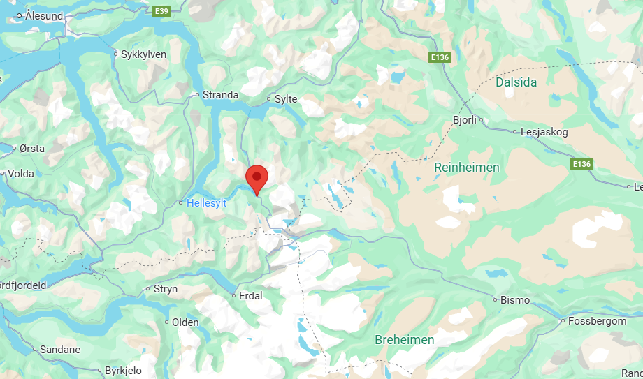
If you’re planning a road trip in Norway, Geiranger is a must-stop. Here’s everything you need to know – from scenic drives and viewpoints to hikes, waterfalls, and boat trips.
The Village of Geiranger – A Tiny Gem at the End of the Fjord
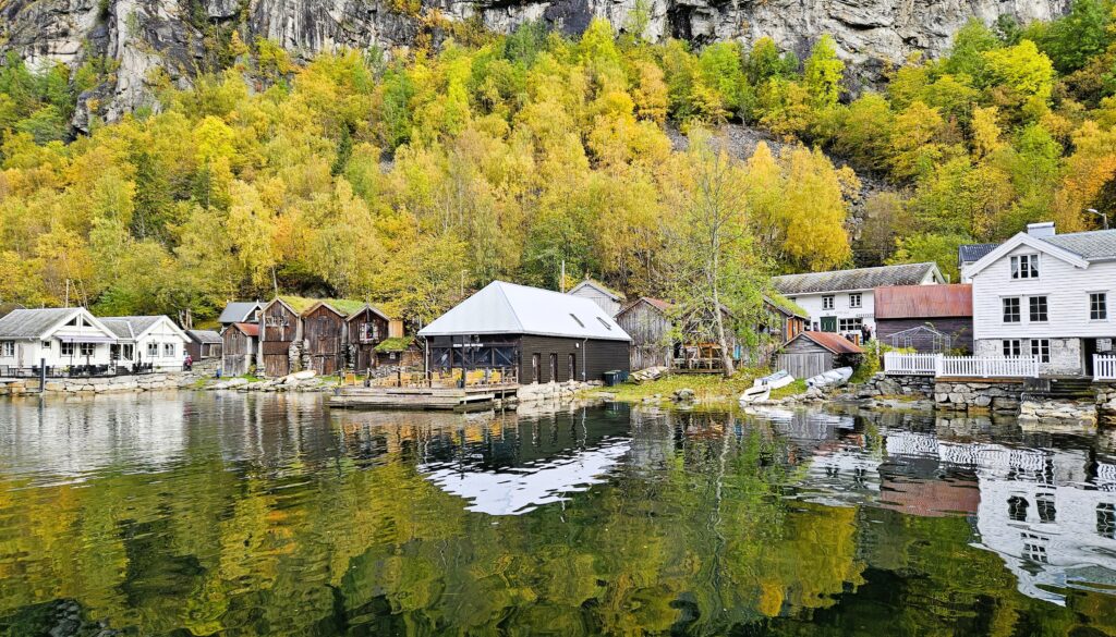
Geiranger itself is small, with just a few hundred inhabitants, but it buzzes with life in summer when travelers from all over the world arrive. Along the waterfront, you’ll find cafés, souvenir shops, and a few cozy restaurants serving local food.
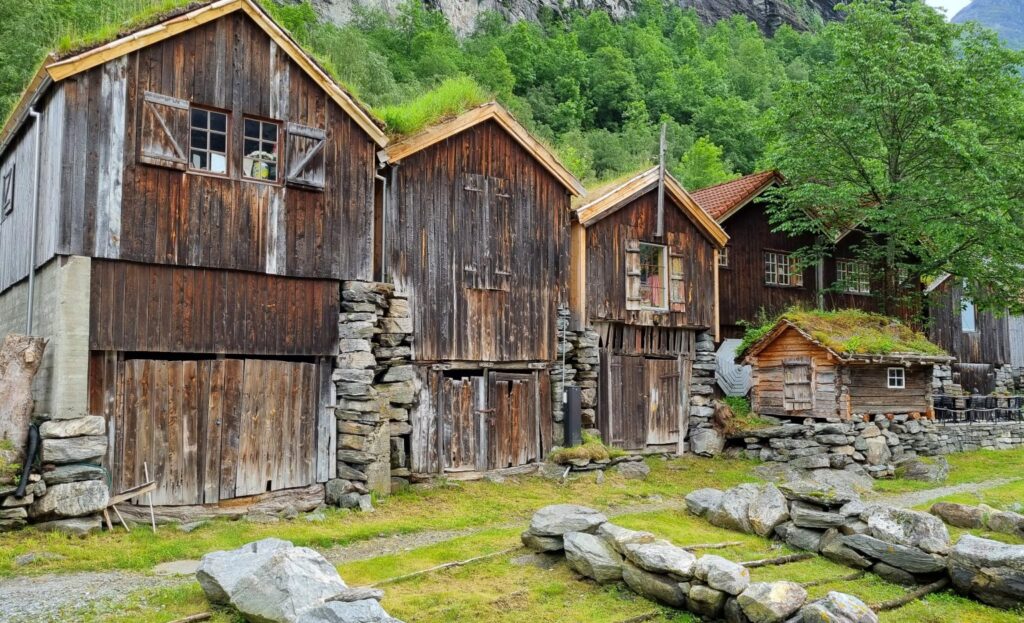
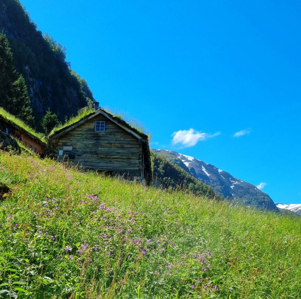
One of the most charming parts of Geiranger is the old farmhouses and historic wooden buildings that tell stories of life in this remote fjord valley before modern times. Many of them are beautifully preserved and add to the authentic feel of the place.
If you’re looking for an itinerary that takes you through Geiranger and other Norwegian highlights, check out our suggested road trip route here.
Exploring the Geirangerfjord
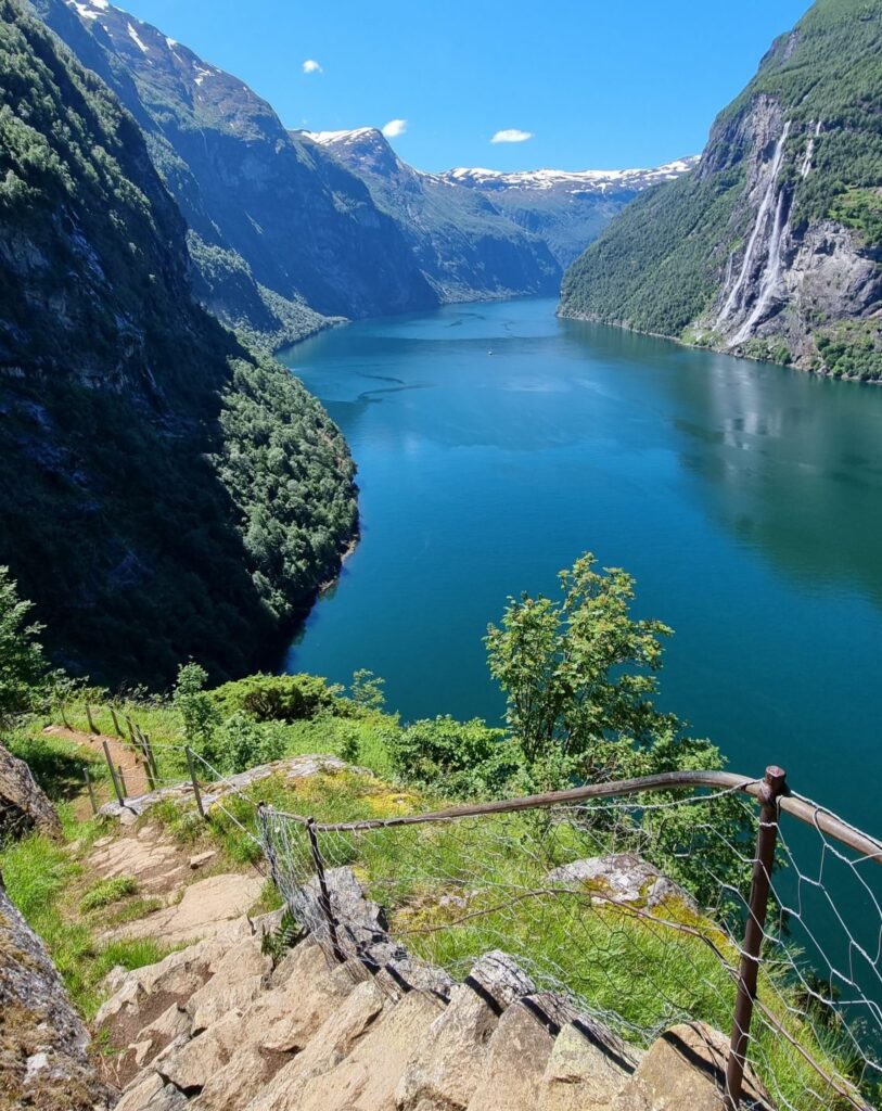
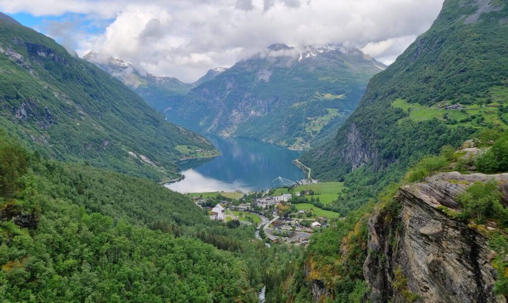
Of course, the fjord itself is the real star here. Stretching like a blue ribbon between sheer mountainsides, the Geirangerfjord is best experienced from the water – and you’ve got plenty of options.
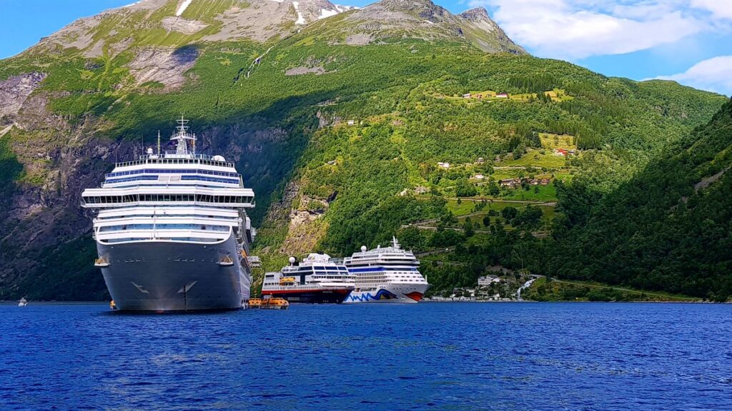
Cruise Ships in the Fjord
When you drive into Geiranger, it’s hard not to miss the huge cruise ships that sometimes anchor in the fjord. They look almost surreal against the tiny village, and when one docks, the streets quickly fill with visitors, cafés get crowded, and tour buses line up for excursions. It brings energy and business to Geiranger – but also changes the peaceful atmosphere.
Boat Tours and RIB Safaris
For your own fjord adventure, you’ve got plenty of options. Take the ferry to Hellesylt or join a sightseeing boat for classic views of the waterfalls, especially the famous Seven Sisters. If you’re after more speed, hop on a RIB safari that skims across the fjord before slowing down by the cliffs. Look out for the famous waterfalls “The Seven Sisters” and “The Suitor” – legends say they’re locked in an eternal dance across the fjord.
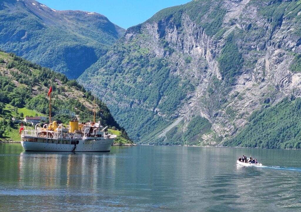
One summer day when we were in Geiranger, the Norwegian royal family visited aboard the Royal Yacht. From our spot at Geiranger Camping, we had the perfect view as the elegant ship anchored in the fjord. It was quite a sight – a reminder that even the royals can’t resist a visit to Geiranger.
💡 Did you know?
In the summer of 2024, Princess Märtha Louise of Norway married her fiancé Durek Verrett in Geiranger. The royal wedding put the little fjord village in the international spotlight – and proved once again that Geiranger is a place fit for both royalty, you and me.
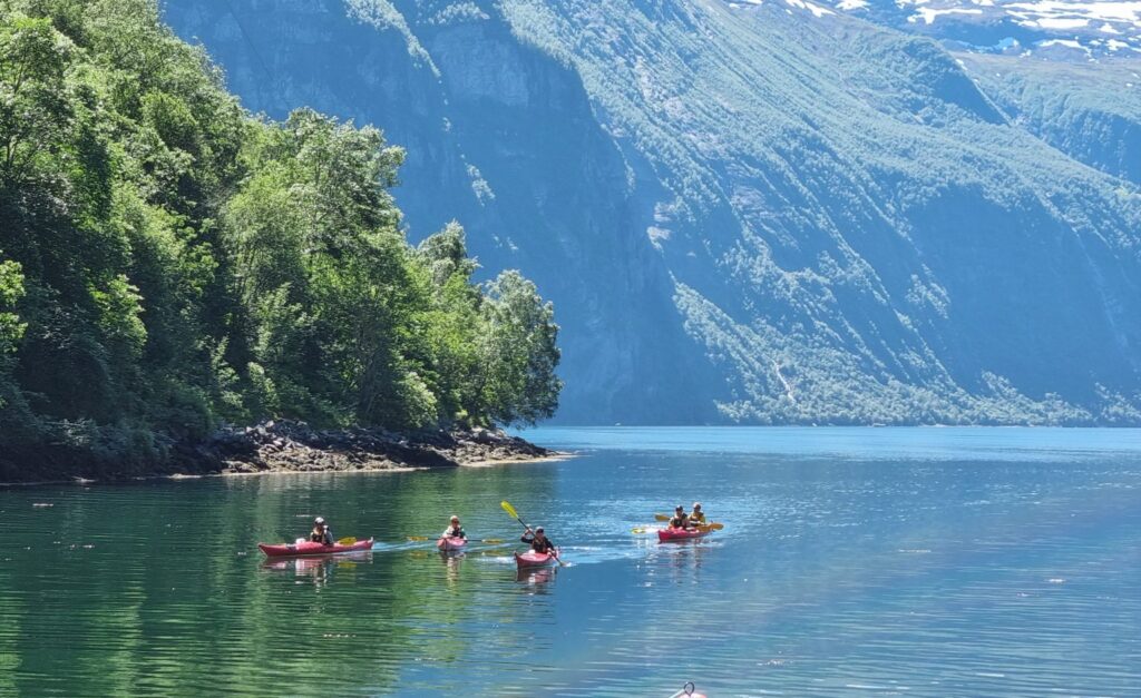
Kayaking – The Quiet Way to Explore
Another popular way to explore is to rent a kayak right in the village. Paddling out on the still water with only the sound of your paddle and the distant roar of waterfalls is an unforgettable experience.
The Immense Beauty of the Fjord
From water level, the fjord feels even more immense – narrow, deep, and surrounded by mountains that rise as much as 1,700 meters straight from the shoreline. The water itself is a deep blue-green, sometimes glassy and calm, other times rippled with wind and passing boats.
No matter how you choose to experience it, the Geirangerfjord has a way of making you feel small – in the very best sense of the word.
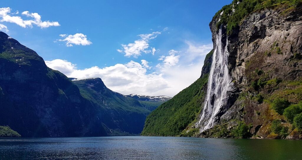
💡 Did you know? Geirangerfjord Facts
- The Geirangerfjord is about 15 km long and up to 260 meters deep.
- Mountains rise as high as 1,700 meters straight from the shoreline.
- The fjord is part of the UNESCO World Heritage Site since 2005.
- Over 100 cruise ships visit Geiranger each summer.
- Its most famous waterfalls are The Seven Sisters, The Suitor, and The Bridal Veil.
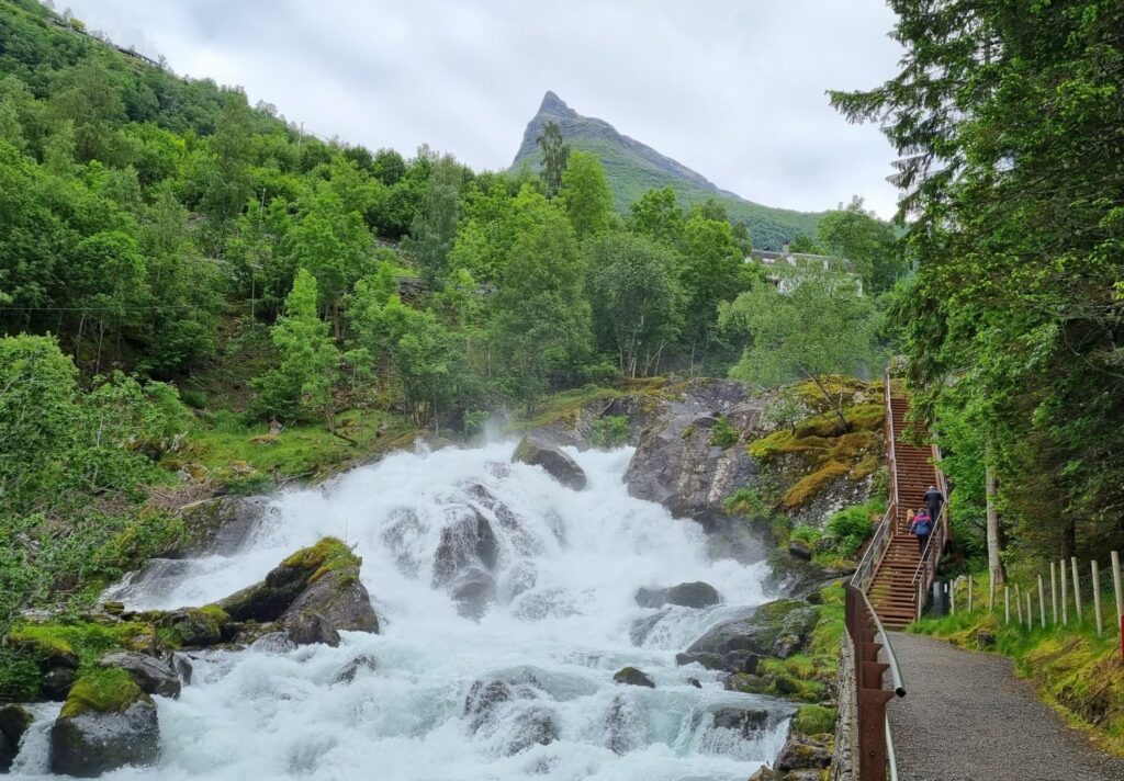
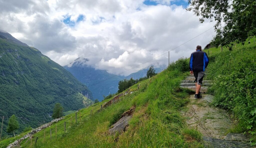
The Waterfall Walk – A Close Encounter with Nature
Right in the center of Geiranger, you can walk the Fossestien (Waterfall Walk) – a staircase and walkway that follows the Storfossen waterfall down the hillside. The power of the water is incredible, and along the way you’ll get unique photo opportunities of both the waterfall and the village. It’s a short and accessible walk, perfect if you just arrived and want to stretch your legs.
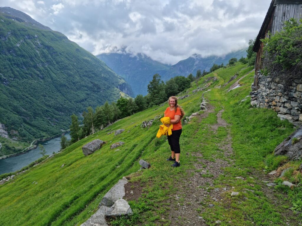
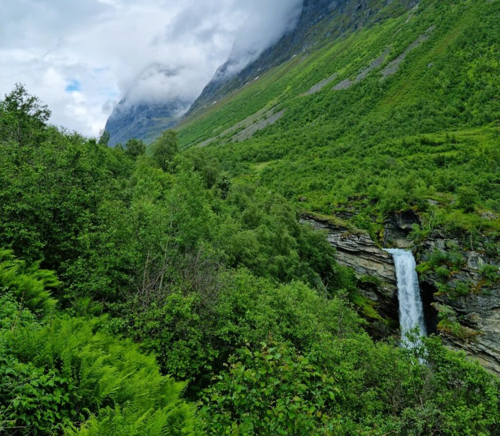
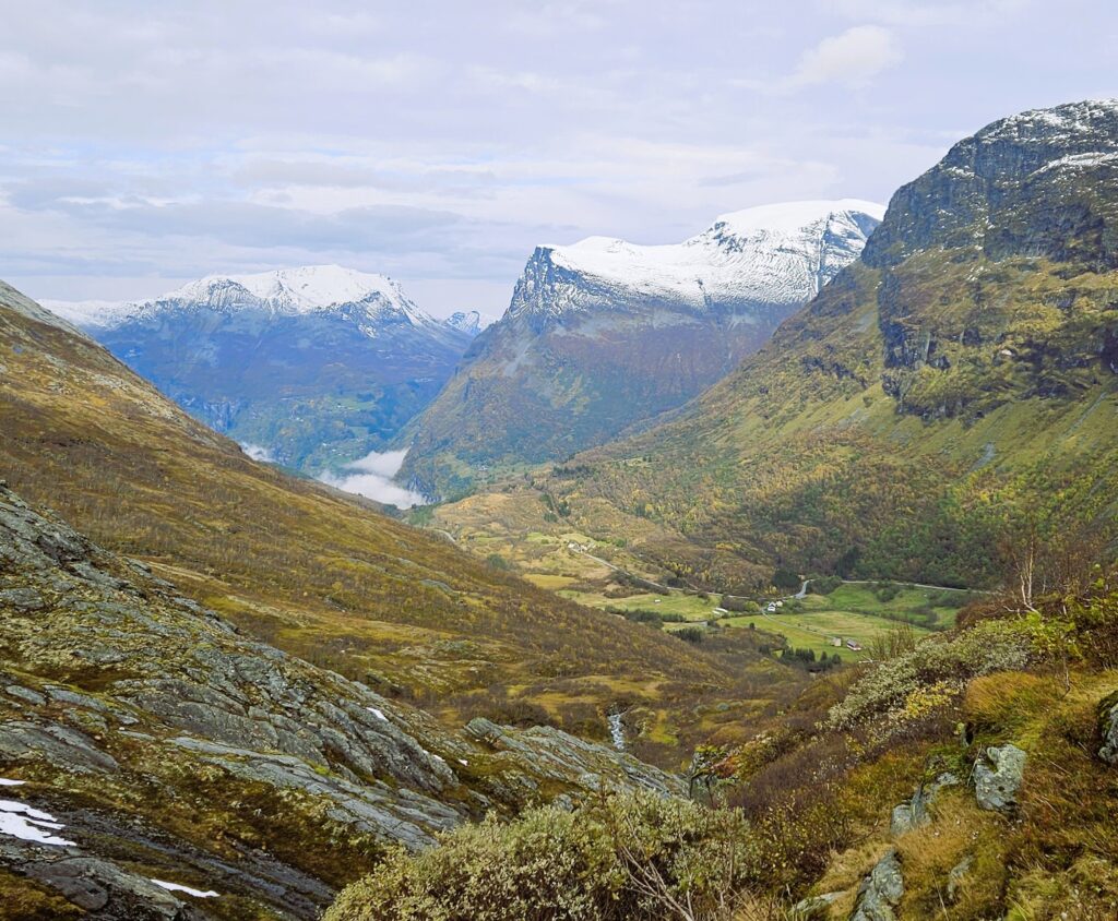
From the Waterfall Walk to Storsæterfossen
The Waterfall Walk may start as a short and easy stroll in the center of Geiranger, but if you follow your curiosity, it can take you much further. Continue upwards to the viewpoint at Vesterås, where you’ll find a restaurant and fantastic views of the fjord, and from there a marked trail leads to Storsæterfossen.
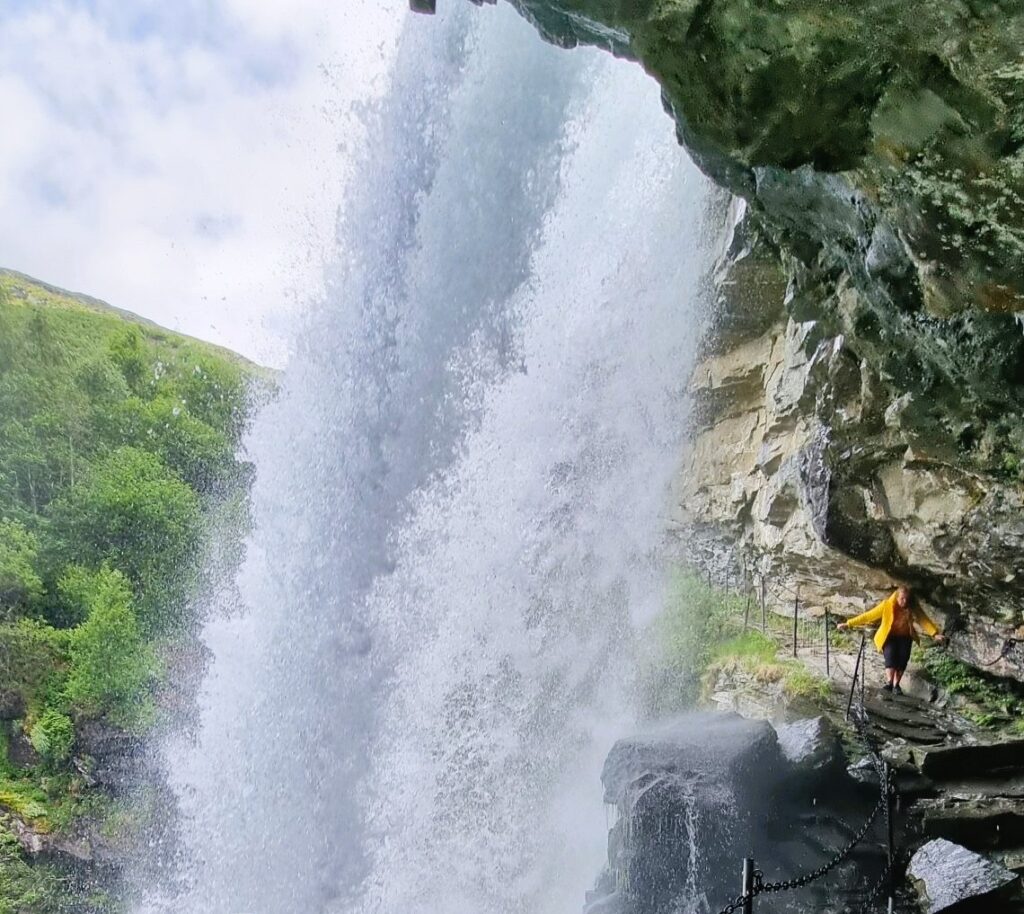
This waterfall is hidden high in the mountainside, and the reward when you finally get there is unforgettable – you can actually walk behind the curtain of water. The hike from Geiranger is about 9 km round trip with 550 meters of elevation gain, so it’s a proper workout.
When “Just a Short Stroll” Turns into a Hike
I have to admit – when I did the hike to Storsæterfossen, it wasn’t planned at all. We had just arrived in Geiranger one sunny afternoon and thought we’d stretch our legs on the Waterfall Walk. “Just a little stroll,” we said. But then the sign to Vesterås looked tempting… and somehow, despite a fair bit of huffing and puffing, we ended up at the farm and restaurant.
Of course, the sign to Storsæterfossen was even more irresistible. “It can’t be that far, right?” So off we went. And when we finally stood behind the roaring waterfall, completely soaked but grinning, we knew it was worth every step.
The only catch? On the way back, the sky opened up and rain poured down. We dashed into the restaurant at Vesterås, dripping wet, and ended the adventure by ordering a taxi back to our camper at the campsite.
What was supposed to be a short evening walk turned into almost 9 km of hiking and a full 550 meters uphill.
Lesson learned? In Geiranger, never underestimate how far your curiosity might take you. Always bring a water bottle, good shoes, and a sense of humor – even for “just a short walk.”
Hike Info: Storsæterfossen via Vesterås
- Start: Geiranger village (via the Waterfall Walk)
- Distance: approx.. 9 km round trip (our hike ended up 7 km since we took a taxi part of the way back)
- Elevation gain: ~550 meters
- Duration: 3–4 hours round trip
- Difficulty: Moderate – steady uphill, but well-marked trail
- Highlights: Fjord views from Vesterås, and the unique chance to walk behind Storsæterfossen
- Read more about this hike in Geiranger here!
💡 Tip: Wear proper hiking shoes and bring water, even if you only plan a “short stroll” – it’s easy to get tempted to go further.
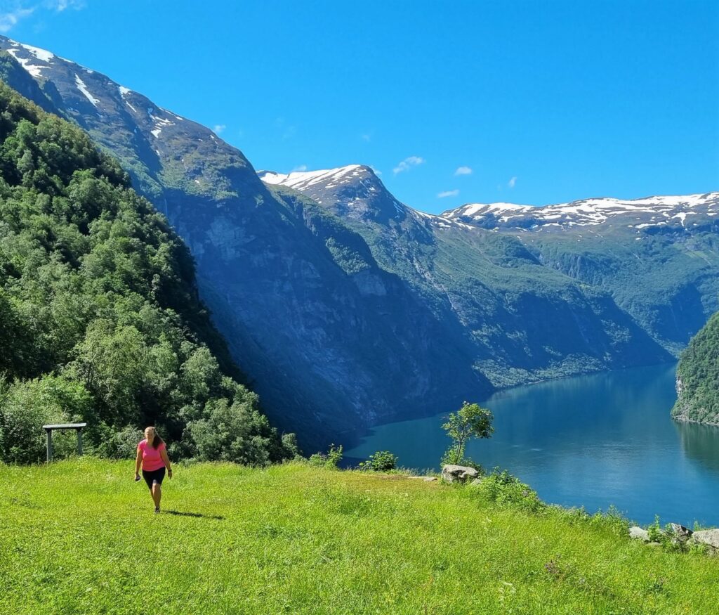
Skageflå – A Hike into History
One of the highlights of Geiranger is the hike to Skageflå, an old mountain farm perched high above the fjord. From here you get one of the most iconic views in Norway: the farm itself with the Seven Sisters waterfall as a dramatic backdrop.
But Skageflå is more than just a viewpoint – it’s a glimpse into a different time. Life on this and several other farms clinging to the cliffs was incredibly hard. Families lived completely isolated from roads and neighbors – or as Norwegians like to say: “Der ingen skulle tru at nokon kunne bu” (where no one would believe someone could live).
The Hike to Skageflå
Most visitors take a boat across the fjord to the trailhead, from where it’s about 2 km uphill with 250–300 meters of elevation gain. The path is steep, but well-marked. At times you walk along the exposed mountainside with the fjord glittering hundreds of meters below. It’s perfectly safe, but if you have a fear of heights, you’ll probably feel it in your stomach.
The Panorama at the Top
As you leave the narrow trail and step onto the plateau where the farm lies, the view suddenly opens up in a breathtaking panorama. The fjord stretches out beneath you, framed by waterfalls and mountains that seem endless. No photo can truly capture the feeling of standing there – it must be experienced in person.
It’s said that this is one of the favorite hikes of the Queen of Norway – and once you see it with your own eyes, you’ll understand why.
The Return to Geiranger
From Skageflå you can return the same way (don’t forget to arrange boat pickup in advance), or continue over the mountain for a longer hike back to Geiranger. The second option is tougher, but it rewards you with even more views over the fjord.
📌 Hike Info: Skageflå
- Start: Boat from Geiranger to Skagehola trailhead (you’ll find several operators nsoffering boat transport at the dock in Geiranger)
- Distance: ~2 km one way (to the farm)
- Elevation gain: 250–300 meters
- Duration: 1–1.5 hours up, less down (but plan extra time – on a sunny day you’ll want to linger at the farm, enjoy your packed lunch, and soak in the views before heading back)
- Difficulty: Moderate – steep but safe trail
- Options: Hike back the same way (requires boat pickup) or continue over the mountain back to Geiranger (longer, more challenging)
- Highlight: Standing at Skageflå farm with the Seven Sisters waterfall as your backdrop – one of Norway’s most iconic views
- Read more about the hike to Skageflå farm here!
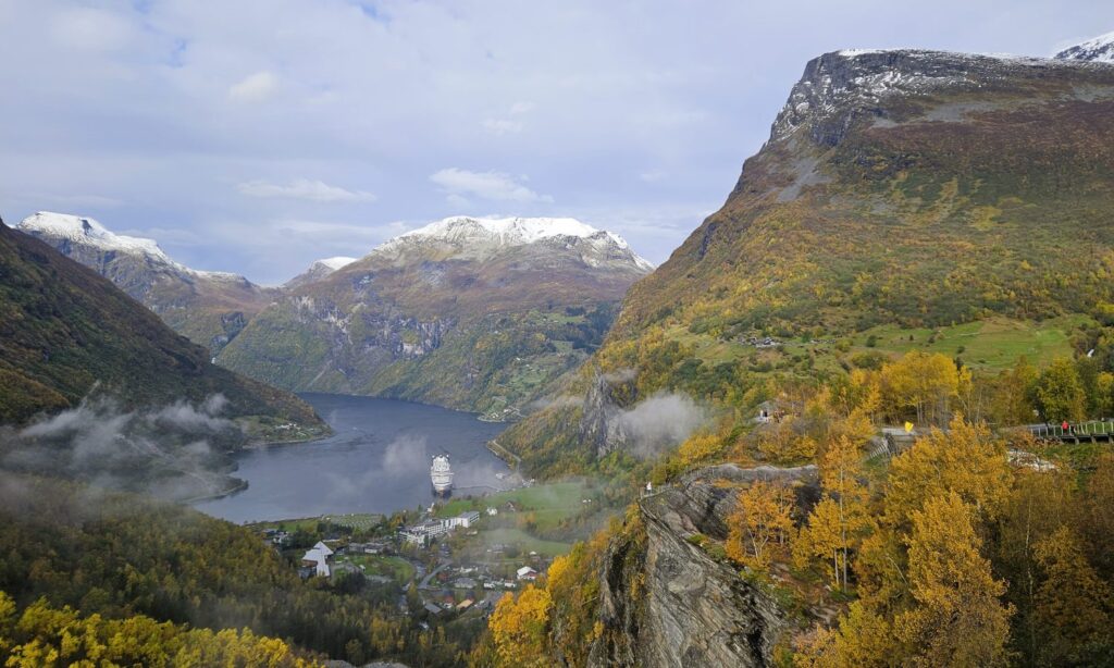
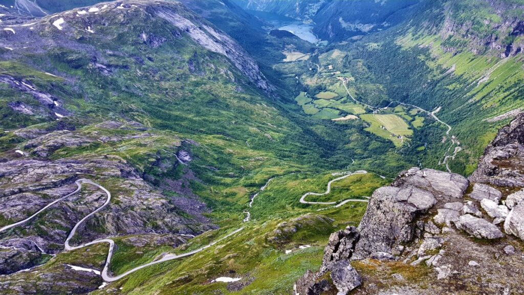
Ørnevegen – The Eagle Road
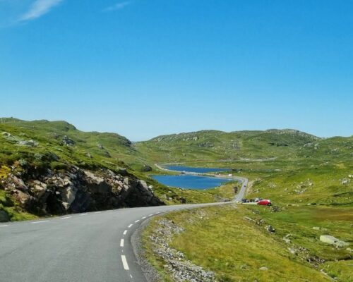
Driving into or out of Geiranger is an adventure in itself. Ørnevegen (the Eagle Road) is a steep, winding stretch with 11 hairpin bends leading down to the village – the road you’ll follow if you’ve come via Trollstigen before reaching Geiranger by car or campervan.
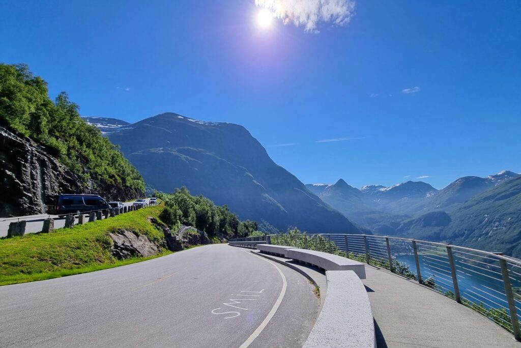
From the Eagle’s Bend viewpoint, you get a true bird’s-eye perspective over Geiranger, the fjord, and the cruise ships anchored far below. It’s one of those places where you simply have to stop and let the view sink in.
The viewpoint itself is a highlight, but don’t just rush there. Take your time and stop at some of the small pull-offs along the way – the scenery is spectacular the entire drive.
Driving in Geiranger means narrow roads, sharp turns, and plenty of photo stops. For more advice, see our full guide with essential tips for driving in Norway.
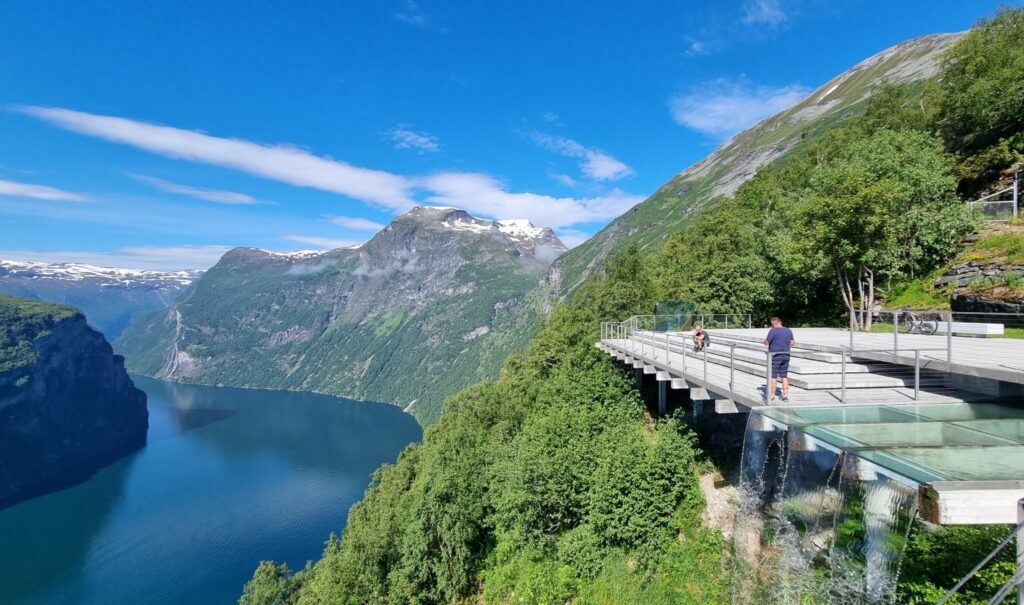
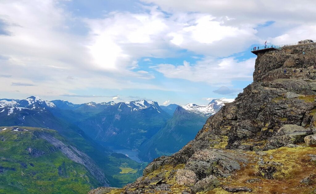
Geirangervegen – Over the Mountains to Dalsnibba
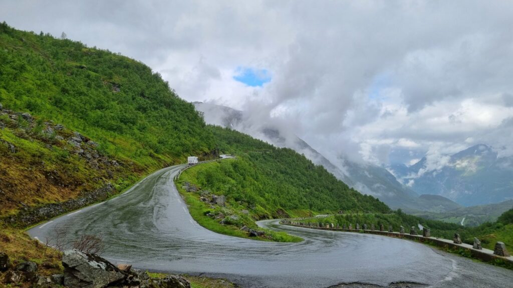
For another perspective, take the Geirangervegen – the road that climbs south of the village and winds its way up into the mountains. No matter if you’re driving up or down, make sure to allow plenty of time. This isn’t a road to rush.
There are countless opportunities to stop along the way: viewpoints with sweeping panoramas, small farms and summer mountain cabins, waterfalls tumbling down the slopes, and rugged peaks rising around you. One stop you shouldn’t miss is Flydalsjuvet, where the fjord unfolds beneath you in one of the most classic postcard views of Norway.
The view from Dalsnibba
At the very top, you’ll find the famous Dalsnibba viewpoint (1,476 m above sea level), accessible via a toll road. From here, the entire Geirangerfjord lies below, framed by jagged peaks and patches of snow that often linger well into summer. It’s one of the highest fjord viewpoints you can reach by car in all of Norway.
I still remember one visit vividly: earlier that same day we had been down by the fjord in 20+ degrees and bright sunshine, strolling in t-shirts. Just an hour later at Dalsnibba, the temperature had dropped close to zero, and we were digging out warm jackets from the back of the camper. That’s Geiranger in a nutshell – dramatic contrasts in both scenery and weather.
Practical Tips for Your Road Trip to Geiranger
Best Time to Visit
- June to September – the ideal season: roads are open, fjord cruises and ferries run daily, and viewpoints like Dalsnibba are accessible.
- October to May – the mountain road Geirangervegen (towards Dalsnibba/Grotli) is closed due to snow.
- Year-round access – Geiranger is still reachable via Ørnevegen (Eagle Road), which is kept open and maintained throughout the winter.
💡 Even in summer, the weather in the mountains can change fast. It might be 20°C by the fjord and close to freezing at Dalsnibba, so always bring an extra layer.
Driving & Parking
Expect narrow roads, sharp turns, and steep climbs – take it slow and enjoy the views.
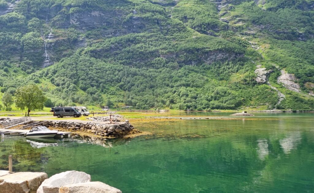
Parking in the village is limited during peak season, so plan to arrive early if possible. Many visitors with campervans choose the local campsites, which are within walking distance of the center.
Where to Stay in Geiranger
Geiranger offers a mix of options:
- Hotels with fjord views if you’re looking for a little luxury.
- Campsites right by the water – perfect if you’re traveling by campervan. Arrive early and you might even snag one of the coveted spots right on the waterfront.
- Cabins and lodges for a cozy, self-catering stay.
Whatever you choose, book well in advance if you’re visiting in summer – accommodation fills up quickly.

Where to Eat
For such a small village, Geiranger has some surprisingly good food experiences. Down by the fjord and among the old wooden houses, you’ll find a few charming restaurants with local flavors. The village is compact, so it’s only a short walk to anywhere.
And if you’re staying at a campsite, nothing really beats cooking your own dinner outdoors with the fjord as your backdrop.
Why Geiranger Belongs on Your Norway Road Trip
Geiranger isn’t just a stop on the map – it’s a place that stays with you long after the journey ends. Between the epic drives, the UNESCO-protected fjord, the dramatic waterfalls, and the traces of history on the mountain farms, it’s the perfect blend of nature and culture.
If you’re planning a Norway road trip, make sure Geiranger is on your list. Trust me – this is one of those places you’ll talk about for years to come. I still do, and I’m Norwegian.
From one road tripper to another: Geiranger is worth every bend in the road.
– Anne Bente 🙂

💬 Have you visited Geiranger? Drop your best Geiranger tip in the comments, and share this guide with a fellow traveler planning Norway.
Continue Your Norway Road Trip
If Geiranger has sparked your wanderlust, you might also enjoy:


4 Comments
Pingback:
Pingback:
Pingback:
Pingback: